How many are dying from heat in Chicago? The city stopped counting and hasn’t shared the tool that could help
A heat vulnerability index created by Northwestern University could direct environmental resources to Chicago’s most impacted neighborhoods, but it’s locked behind bureaucracy
Real journalists wrote and edited this (not AI)—independent, community-driven journalism survives because you back it. Donate to sustain Prism’s mission and the humans behind it.
Researchers at Northwestern University in Illinois say they’ve created a heat vulnerability index that could save lives in Chicago’s most at-risk neighborhoods. However, the tool remains hidden from the public, locked behind what city officials and researchers described as a “collective decision,” a “hosting issue,” or a need for “white paper review”—explanations that appear to contradict each other and leave no one accountable.
Interviews with half a dozen residents and community workers in predominantly Black Chicago neighborhoods that are vulnerable to deadly heat—Pullman, Roseland, Garfield Park, and Englewood—revealed that half of them had never heard of the tool. Those who did were only aware because they were connected to specific organizations or listservs. One Englewood resident who learned about the index’s development said she didn’t feel welcome in those spaces and that it seemed like they were “for specific people” because they appear to cater to older residents.
Residents interviewed by Prism described this as information gatekeeping, and it’s taking place in areas where environmental cumulative impacts already burden residents. It’s also happening in neighborhoods where Black residents die sooner than their non-Black neighbors, where heat is a documented killer, and where a completed data tool could direct lifesaving resources—if anyone could access it.
The information gap
“Every aspect of who you are is pretty much based on your environment,” said Ayme Robinson, a 28-year-old Chicago Public Schools educator, artist, and resident of the Englewood neighborhood.
Despite advancements, Englewood, a neighborhood with a declining population of 24,322, is still facing hurdles due to historical disinvestment. Robinson called the fact that her community doesn’t have vital information related to heat “very disheartening.”
The Heat Vulnerability Index (HVI) is a neighborhood-by-neighborhood map developed by Northwestern University researchers in partnership with the city, NASA scientists, and community organizations. Using data related to factors such as tree cover, housing quality, poverty rates, and chronic health conditions, the index is designed to identify which Chicago neighborhoods face the highest risk during extreme heat events. Internal city emails show that work on the project began in January 2022, with hundreds of coordination meetings held throughout 2023 and 2024. References to targeted data releases appear in a city email log obtained by Prism via a records request.
However, nearly four years since the project began, the HVI remains unavailable to the public, absent from city websites, and unknown to many residents in the very neighborhoods researchers are studying.
The Chicago Metropolitan Agency for Planning (CMAP) houses a climate resilience program, focused on data and long-range planning for climate challenges, particularly flooding and heat. The agency openly acknowledges Chicago’s escalating climate risks.
Kate Evasic, who leads the program, told Prism that she has witnessed this acceleration firsthand.
“My work at CMAP, in my work in general, began focused on stormwater management and water quality … but it’s been extremely clear to me that even over the last five years, those risks have really accelerated,” Evasic said. “And now just looking at the storms that hit the region in July, it was back-to-back, torrential rains that very quickly … created these flash flooding conditions, especially in urban areas. … The work has naturally shifted with the growing crisis of climate change.”
However, the predominantly Black communities most affected by climate change remain excluded from the data and tools that could help them prepare. These neighborhoods bear the compounded burden of decades of disinvestment: fewer trees for shade, older housing stock with poor insulation, and limited access to air conditioning—legacies of historic redlining and industrial zoning that stripped them of the green infrastructure that wealthier, whiter neighborhoods use to stay cool.
Robinson was aware of the HVI, but still expressed feeling excluded from the data and resources offered by the city to help mitigate extreme weather.
Katia Balba, a policy organizer with the interfaith organizing coalition Alliance of the SouthEast (ASE), said this is a dynamic that organizers are working to address. “Data alone can be empowering for community organizers who use it to tell the story, but for residents living in crisis, it can also be terrifying without a path forward,” she said.
Northwestern’s Daniel Horton, the scientist who is leading the HVI project, said in an interview with Prism that his team, known as the Defusing Disasters Working Group, engaged approximately 2,000 community members and community organizations across Chicago and surveyed all 50 of Chicago’s alderpersons. So far, Chicagoans have said they want water at bus and train stops, more emergency shelters, and for parks and other green spaces to be prioritized, according to an article in the Chicago Tribune.
“We had some internal discussions, and we’re looking for an idea, something to work on together,” Horton explained. He emphasized the project’s “community-engaged process,” where “the knowledge that city experts bring and the knowledge that academics bring is equally valued with the lived experience knowledge of our community members.”
Still, despite the working group’s efforts, there are still local residents such as Brandon Towns who are unaware of the HVI. The 27-year-old is an operations analyst living in the Roseland neighborhood, and he told Prism that ”informational gatekeeping is the norm for America.”
Balba acknowledged that in geographically large wards in Chicago, it can be difficult for a single alderperson to effectively reach all local residents. In Southeast Chicago, where ASE organizes, she said officials often rely on social media posts or email blasts to reach residents.
“In contrast, residents in other wards receive printed flyers, door knocking, and more consistent direct engagement,” Balba explained. “Because of this information gap, many residents are not fully prepared to winterize their homes or respond to flood emergencies. They may not even realize they’re living in high-risk areas because the conditions they face have become normalized. Without access to data, they can’t advocate for more resources or targeted programs, and that limits both individual preparedness and collective power.”
When pressed on which neighborhoods were consulted, Horton cited Rogers Park, Englewood, and “many different neighborhoods throughout Chicago.” He offered to provide a spreadsheet of contacts, but ultimately did not send the list to Prism.
Sam Corona, also a community organizer with ASE, told Prism that the murkiness of the university’s outreach plan illustrates some of the shortcomings related to the index. “Real engagement leads to policy or programmatic change, not just another report that gathers dust,” Corona said.
“We are the last priority”
While researchers collected data on which neighborhoods face the highest heat risk, residents in those same areas continue to navigate environmental hazards that the city has long ignored.
Robinson said that her neighborhood in Englewood suffers from inadequate garbage disposal, with trash overflowing in many areas and a lack of accessible garbage cans. This poor sanitation is compounded by widespread street flooding, as debris blocks drainage and leads water to accumulate during storms, ultimately causing flooded basements and other damage to homes.
Robinson also highlighted the detrimental effects of industrial dumping, noting that construction companies and other businesses often dispose of waste—including potentially hazardous materials—in empty lots throughout the community. She expressed concern about the presence of new industrial operations, such as trucking companies and shipyards, which have increased local traffic and further diminished available space for essential community services.
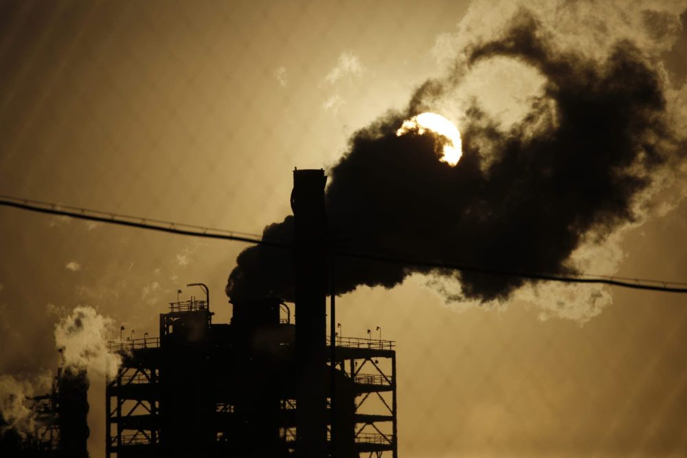
Robinson’s experience reflects a citywide pattern. Black communities have long been “sacrifice zones,” where industrial operations are centered, sickening residents. Jason Ferguson, 59, is a resident of Garfield Park. The former track and “alternative sports” Olympian and coach said Chicago could be doing more for residents in his community.
Ferguson told Prism that Garfield Park has the lowest life expectancy in Chicago. In the predominantly Black neighborhood, residents are expected to live only to about 67 years old on average, while in wealthier, white areas of the city, life expectancy can reach as high as 83 years.
This is what systemic exclusion looks like: Communities are left out of conversations that directly affect their health and survival, generation after generation.
Jason Ferguson, Garfield Park resident
“For decades, no one talked about the health risks of steelmaking at U.S. Steel on the Lake Michigan shore,” Ferguson said. “Today, we’re seeing the same silence around issues like metal shredding at General Iron or the health implications of new data centers and the Illinois Quantum and Microelectronics Park. This is what systemic exclusion looks like: Communities are left out of conversations that directly affect their health and survival, generation after generation.”
One community bearing these impacts is Englewood, where Robinson told Prism that the industrial waste in Chicago’s Black communities has a wide array of consequences for young people.
“[It] has a major impact on the children walking down the street, the smells, the way that they look at their community,” Robinson said. [There] are property owners and real estate companies that are cutting corners and are leaving waste and disenfranchised communities because they think no one’s paying attention. But I’ve been paying attention for 10 years.”
Towns, from the Roseland neighborhood, echoed Robinson’s concerns. He told Prism that he doesn’t see “much support” from government officials when it comes to making his community safer, especially during extreme weather events.
“Even the snowplowing isn’t consistent,” he said. “I think the city can do a better job salting public walkways like the bridge over the expressway between 95th and the 100s. When walking from the train, I have to hold onto the railing so I don’t slip into the street. I haven’t seen much support for heat and cold snaps that I can remember. As a child, our basement flooded pretty regularly, but I think support came from insurance rather than the city.”
According to a statement from Ryan Gage, the public affairs director for the Department of Streets and Sanitation, 60% of all service requests were located on the south and west sides across 27 wards. However, Gage did not provide the community-level metrics or response time data requested to verify service consistency across neighborhoods, nor did he address resident concerns about resource allocation favoring wealthier areas.
Towns and other residents have reached a point of frustration with the city’s neglect, though he noted that Chicago’s inaction isn’t entirely surprising given its long history of disregard for Black residents. Towns also pointed to systemic issues such as redlining and the abrupt removal of public transit infrastructure, arguing that meaningful improvements only occur when gentrification displaces low-income communities.
Ritch Barnes, 64, an academic adviser who has lived in the Pullman neighborhood for seven months and was also unaware of the HVI, said information related to climate should be more readily accessible.
“I’m sure you would have to seek this information yourself,” he said, noting that he’s never received any support from the city during environmental emergencies. “I don’t think it was something that was in the mail or posted somewhere.”
Barnes suggested that if there is information for high-risk environmental emergencies, residents should receive a text from the city, similar to alerts when a child is abducted.
Beyond better communication, residents who spoke to Prism said they want consistent delivery of basic services they already pay for, age-inclusive resources, officials who show up during crises, and protections from industrial operations that treat their neighborhoods as sacrifice zones. Fundamentally, they want the same chance at a healthy life that wealthier communities take for granted.
“Living in a predominantly African American neighborhood, I find that we are the last priority,” said Barnes, detailing a pattern that stretches back decades.
Barnes can still recall a horrendous blizzard in 1979 when then-Mayor Michael A. Bilandic ordered the Chicago Transit Authority to prioritize all trains going north and to hold off on trains going south, where most Black residents lived. “I was 18 years old when this happened, and I stood in the cold for hours before a train went south,” Barnes said. “[Bilandic] also had Streets and Sanitation plow neighborhoods with people of color last. I haven’t had an experience that racist and boneheaded since that time, but things [today] could certainly be improved.”
Tracking heat vulnerability
The pattern Barnes described in which Black neighborhoods are Chicago’s “last priority” has persisted for 45 years, from the 1979 blizzard and the 1995 heat wave, to today’s neighborhoods with the most heat vulnerability. The practice of treating Black communities as an afterthought during environmental emergencies persists across various state and federal administrations.
But getting a straight answer about the HVI and why it is not yet public only garnered contradicting explanations.
Finley Hay-Chapman, a postdoctoral researcher at Northwestern working on the project, characterized the delay as primarily a technical problem. “One of the issues that we’ve been running into is really finding a place on the city government’s website to actually put this tool on so that it would be publicly available,” Hay-Chapman explained, telling Prism the index should be available by next month. “It was mainly issues between different city [departments] not knowing if they had the resources to host this tool.”
When asked why the index hasn’t been released, Horton explained another barrier: a white paper that’s currently being drafted by a team that “meets every week.”
“The white paper, when it is complete, will be reviewed by the city and then we will release both the white paper and all the data underlying the index,” Horton said. “And so once that step is complete, all of the information will be made public.”
Horton told Prism that the decision to complete the white paper and release the data as a whole was made by the working group, which includes municipal leaders, academics, and community members. “Our goal is that this tool is trusted by the community and used by the city and for it to be a tool that is used by the city, it needs to go through the review process, which requires the completion of the white paper,” Horton said.
Prism has filed a series of records requests with city and state agencies, including one with the Department of Environment (DOE) focused on the agency and the working group’s outreach efforts. The request sought information related to which neighborhoods were consulted, what accessibility plans existed for non-English speakers, what barriers prevented public release, and how much the city paid Northwestern.
While the records requests are still being processed, the Department of Environment told Prism that the city of Chicago is looking forward to finalizing the policy priorities and supporting “the realization of recommendations in the future.”
“DOE is a proud partner of the Defusing Disasters Working Group with Northwestern University, as well as multiple civic and community organizations,” the statement read. “Earlier this year, the coalition made a collective decision to present a preview of a preliminary version of the Heat Vulnerability Index while also focusing on increased efforts to engage the community to ensure a robust response to the policy priorities proposed through the working group.”
Another records request, this one filed Oct. 20 with the Chicago Department of Public Health (CDPH), seeks emergency department visit and hospitalization data for heat-related illnesses in Englewood and East Garfield Park. These are the neighborhoods where Ayme Robinson and Jason Ferguson live that are vulnerable to heat waves. CDPH acknowledged receipt of the request the same day it was filed. More than 10 days later—twice the legally required five-day response period—there was still no response from the agency. On Oct. 30, Prism followed up on the request, and on Nov. 4, CDPH claimed it has no extant data reports that fit Prism’s request. The department said it could possibly compile such data but is not obligated to do so under the state’s records laws. The agency directed Prism to use its data request form instead. A request was filed on Nov. 7.
On Nov. 18, CDPH epidemiologist, Dana M. Harper-Jemison, told Prism that CDPH does not track heat-related hospitalizations and suggested Prism use the Chicago Health Atlas to review data related to heat-related mortality at the “community-level.”
Heat is the leading cause of weather-related deaths in the U.S. Yet, from 2019 to 2023, Chicago reports only 18 heat-related deaths—about 3.6 deaths annually in a city of 2.7 million people, according to the Chicago Health Atlas. By comparison, New York City, with active heat surveillance, reports an average of 525 heat deaths per year.
According to public health experts at the Environmental Protection Agency, many heat deaths go unrecognized because heat often kills indirectly by worsening underlying conditions such as heart disease, so deaths may be recorded as cardiac events rather than heat-related. Cities with robust heat surveillance systems explicitly track both direct heat-stress deaths and heat-exacerbated deaths. However, the CDPH does not track heat-related hospitalizations, and the Illinois Department of Public Health told Prism it no longer maintains the emergency department surveillance data it collected from 2012 to 2014.
Older data provides some insight into the conditions faced by Chicago’s Black residents. Illinois Department of Public Health records show 149 heat-related deaths in the state between 2010 and 2013, with middle-aged and elderly men dying at the highest rates. This isn’t the first time Illinois has failed to make heat vulnerability data accessible. A decade ago, the Building Resilience Against Climate Effects (BRACE-Illinois), a collaboration between the University of Illinois at Chicago School of Public Health and the Illinois Department of Public Health, promised a heat toolkit for local health departments. Data was supposed to be made available online through a now-defunct BRACE-Illinois website.
Instead, BRACE-Illinois released a general climate and health report with educational content. More specific county-level vulnerability data that health departments could use to direct resources during heatwaves never materialized. Now, a different team at a different university is building a similar tool that for now, amounts to the same outcome: Communities most vulnerable to heat remain without the actionable information that could protect them.
When contacted for comment, the UIC School of Public Health directed Prism to the IDPH. The IDPH did not respond by publication time.
The same Black neighborhoods with large life expectancy gaps await data that could help close that gap. Why do Chicago’s communities of color continue to be subjected to research without immediate outcomes? How many people have died from heat since 2013, when the state stopped posting data publicly?
When asked for comment about why heat mortality data stopped being publicly reported after 2013, Andy Buchanan, deputy director of communications for the Illinois Department of Public Health, said, “I’m told we actually didn’t track heat mortality regularly even before 2014 but that the Chicago Department of Public Health did and then later halted that. And we didn’t then take that over. Occasionally we would do data assessments for specific projects but not annually.”
Hosting summits about weather impacts while declining to count heat fatalities mirrors a broader pattern: more coordination, planning, and future promises, while the fundamental work of data collection and transparency appears to remain incomplete.
Since at least 1995, the South Side and West Side neighborhoods have faced the highest heat mortality risk, but only 22% of cooling centers and 18% of warming centers in Chicago are located in these vulnerable areas, according to CDPH databases. Then, as heatwaves intensified, Chicago stopped tracking who died and where—and the state did not pick up the responsibility. Now, researchers at Northwestern have created a tool to identify heat-vulnerable neighborhoods, but neither the city nor the state can measure whether it would save lives because they are not counting the dead.
Ferguson said that all residents can do is work to remove local officials from office when they don’t carry through on their promises or meet the demands of their constituents. “Outside of that, we can march, we can petition, but they got the power that we’ve given them,” Ferguson said. “[The] only way we can take it away is by removing them from their positions. We have to be the change ourselves.”
Editorial Team:
Tina Vasquez, Lead Editor
Carolyn Copeland, Top Editor
Rashmee Kumar, Copy Editor
Author
A Black journalist, poet, organizer, and connoisseur of croissants, NaBeela Washington (she/her) writes about what’s possible. She holds a Master's in Creative Writing and English from Southern New Ha
Sign up for Prism newsletters.
Stay up to date with curated collection of our top stories.